


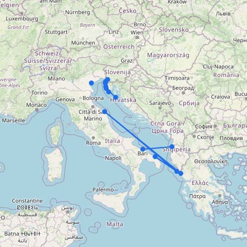
Adriatic Sea Ferry Map
The map above shows the Adriatic as a series of distinct ferry corridors rather than one continuous network.…
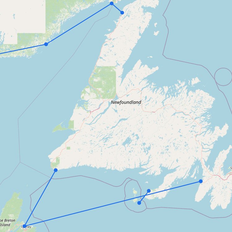
Ferry Routes to Newfoundland
The main ferries from Nova Scotia to Newfoundland depart from North Sydney. Marine Atlantic operates a year-round crossing…
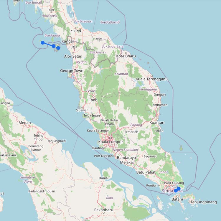
Ferries to Malaysia
Malaysia’s international ferry network consists of several separate regional corridors. Ferries connect the country with Thailand, Indonesia and…
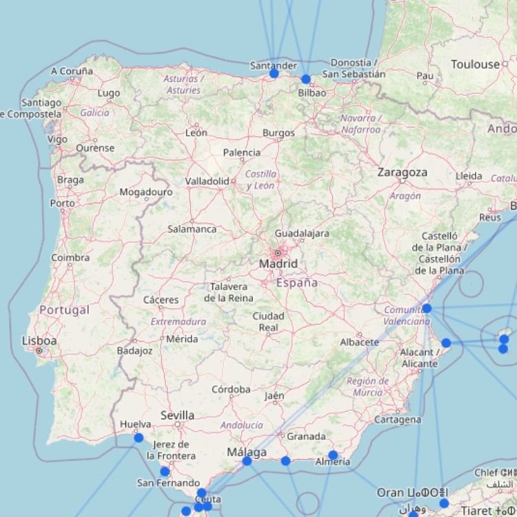
Spain Ferry Map
Spain’s ferry network is best understood as several separate travel corridors rather than one national system. Mainland ports…
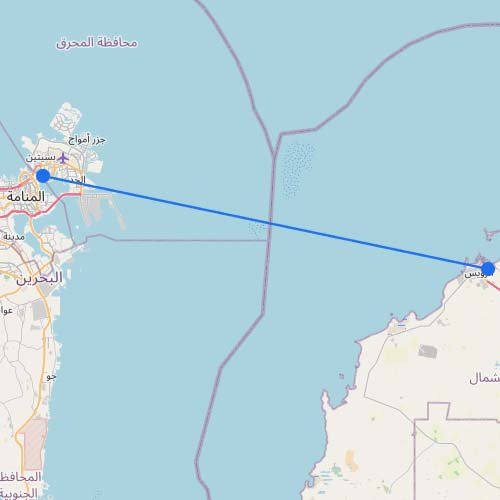
Ferry to Bahrain
Skip the border traffic entirely. You can cross the Gulf on Masar Group’s passenger-only fast ferry coming straight…
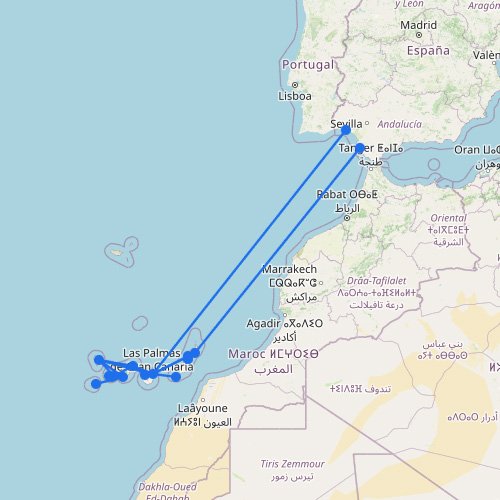
Canary Islands Ferry Map
The Canary Islands ferry map shows a network built around several main hubs rather than direct routes between…
No maps match this filter.