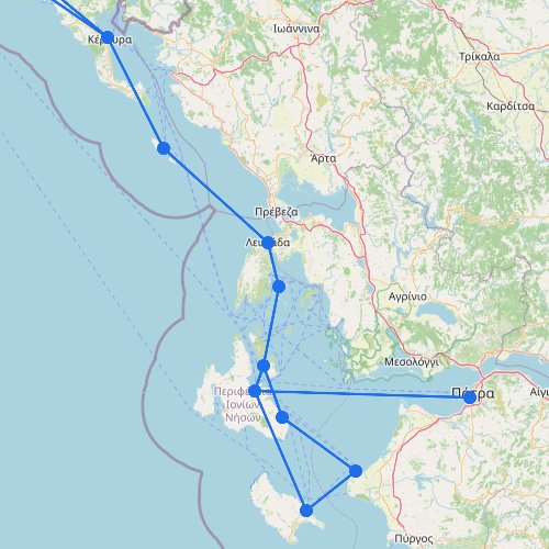
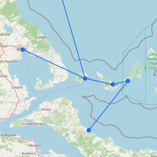
Across the map, the Ionian Islands form a compact but important ferry region on the western side of Greece. Compared with the wider Aegean networks, these routes run over shorter sea distances, connect greener islands, and rely on strong links with the mainland. As a result, the system feels more practical and direct, with ferries acting as the main link between coastal Greece and the islands offshore.
How the Ionian Islands map makes routes easier to follow
The Ionian Islands can be easier to understand than many other Greek ferry areas because the crossings are shorter and the mainland connections are stronger. This is a west-facing island group, so how the coast links to each island often matters more than long island-to-island chains.
Start with the mainland: Routes make the most sense when you read them from coastal Greece out toward islands like Corfu, Kefalonia, Lefkada, and Zakynthos.
Fewer complicated transfers than the Aegean: You’re less likely to get stuck untangling long transfer patterns, especially compared with the Aegean Islands.
It’s easier to spot what’s essential: The map usually makes it clear which crossings are core and which ones are more limited.
Read outward, not across a chain: The Ionian map works best from the mainland out, rather than trying to connect island to island across a long stretch.