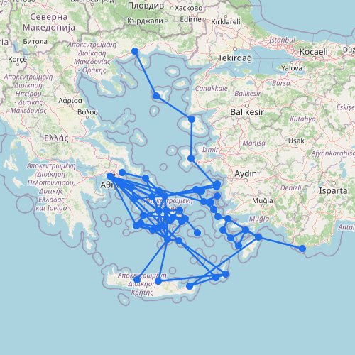
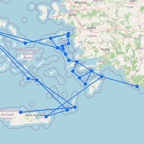
The Greek Islands are served by one of the largest island ferry networks in Europe. This page brings together the main regions—Cyclades, Dodecanese, Ionian Islands, and Saronic Islands—so you can see how the island groups fit together.
On the map, the Greek Islands can look like one big ferry network. In real life, each island group runs on its own schedule, with its own main ports and its own weak links.
Before you follow the routes across the islands, keep these two points in mind:
The biggest mistake is assuming all islands behave like the same network. The Cyclades, Dodecanese, Ionian Islands, and Saronic Islands work differently.
Islands that seem close together don’t always have direct sailings, so it usually pays to find the main transfer hubs first before planning a multi-island trip.