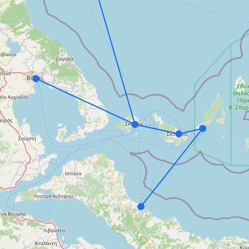
On the route map, the Dodecanese stand out as one of Greece’s more spread-out ferry systems, with long lines of islands reaching close to the Turkish coast. The network combines major hubs with smaller ports, so some crossings run often while others depend on the season and the type of vessel. For many travelers, this is the part of the Aegean where ferry planning starts to feel more regional and less straightforward.
The Dodecanese cover a long stretch of the southeastern Aegean. On the map they look like one chain, but in practice the routes feel more regional and uneven, so it helps to read them that way.
Some islands connect the system: Routes around Rhodes, Kos, Kalymnos, and Patmos are usually easier to follow than the outer edges.
Long chains take more work: It’s not like the Saronic Islands, where short crossings make the network simpler to read.
Vessel type changes the options: Fast craft and conventional ferries can give noticeably different route choices across the same island group.
Look east and south for the pattern: The farther east and south you go, the more the Dodecanese behaves like a stretched edge network than a tight cluster.