

Ferry region
Recently updated
↗
970
views · 30 days
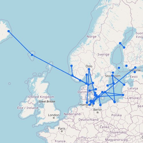
Scandinavia Ferry Map
The interactive ferry map on this page primarily covers ferry routes across Scandinavia and the Baltic States, but…
33
routes
45
ports
16
operators
Explore this ferry region
Destination
Recently updated
↗
270
views · 30 days
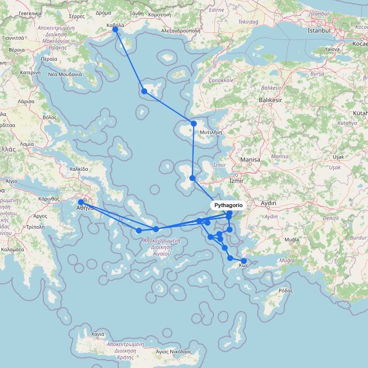
Ferries to Samos
Sitting a mere 1.2 kilometers off the Turkish coast, the twin ports of Vathy and Karlovasi process over…
5
routes
18
connections
4
operators
Explore ferries to this destination
Destination
Recently updated
240
views · 30 days
Ferries to Kefalonia
The main ferry routes to Kefalonia depart from the mainland port of Kyllini, taking just 90 minutes. Levante…
5
routes
11
connections
3
operators
Explore ferries to this destination
Destination
Recently updated
↗
230
views · 30 days
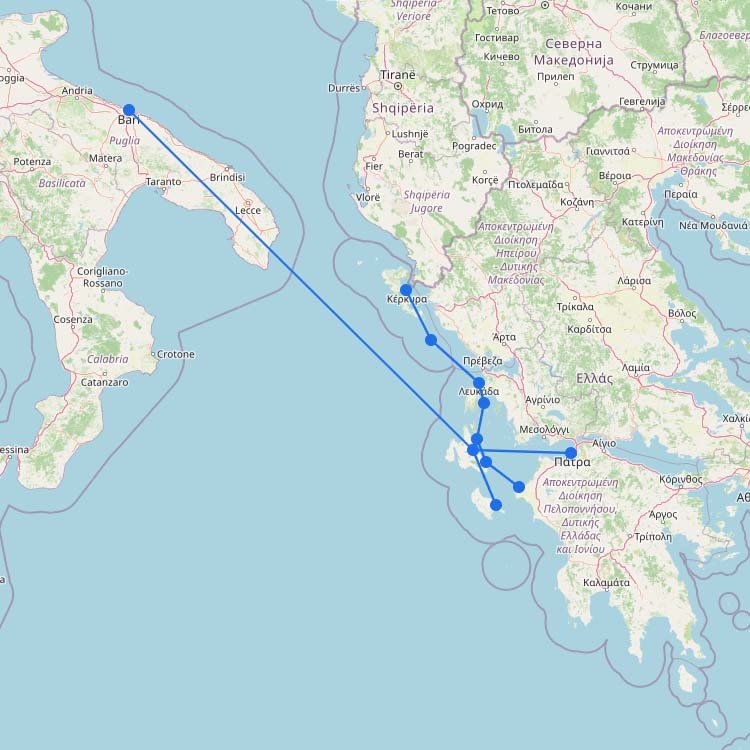
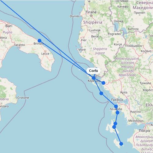
Ferries to Corfu
As shown on the interactive map above, ferry routes to Corfu include a mix of longer international crossings,…
6
routes
12
connections
9
operators
Explore ferries to this destination
Destination
Recently updated
↗
210
views · 30 days
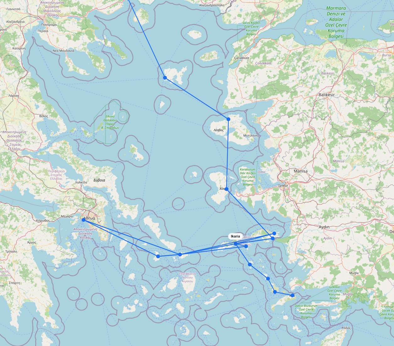
Ferries to Ikaria
Embrace the slow pace of the legendary Blue Zone by boarding a Blue Star Ferries ship out of…
3
routes
15
connections
2
operators
Explore ferries to this destination
Destination
Recently updated
↗
180
views · 30 days
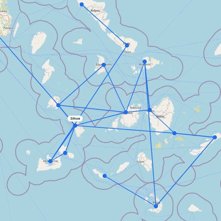
Ferries to Sifnos
Seajets and Aegean Sea Lines are the primary operators serving the western Cyclades, transporting approximately 100,000 passengers annually…
5
routes
15
connections
1
operator
Explore ferries to this destination
No maps match this filter.