Destination
↗
4.2K
views · 30 days
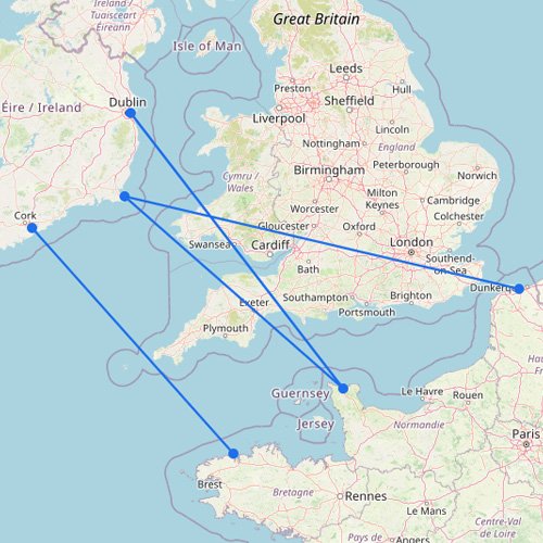
Ferries from Ireland to France
France is easily reached from Ireland by ferry, and it’s also the only direct way to get to…
5
routes
7
connections
4
operators
Explore ferries to this destination
Destination
2.9K
views · 30 days
Ferries from Ireland to the Netherlands
Ferries to the Netherlands mainly operate from the UK, with routes to ports such as Hook of Holland…
10
routes
8
connections
5
operators
Explore ferries to this destination
Destination
2.6K
views · 30 days
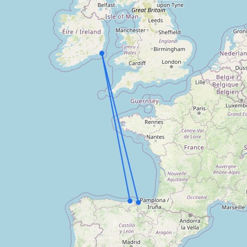
Ferries from Ireland to Portugal
Portugal is a great country to travel to, and thanks to the ferry, you can do so with…
2
routes
3
connections
1
operator
Explore ferries to this destination
Destination
1.1K
views · 30 days
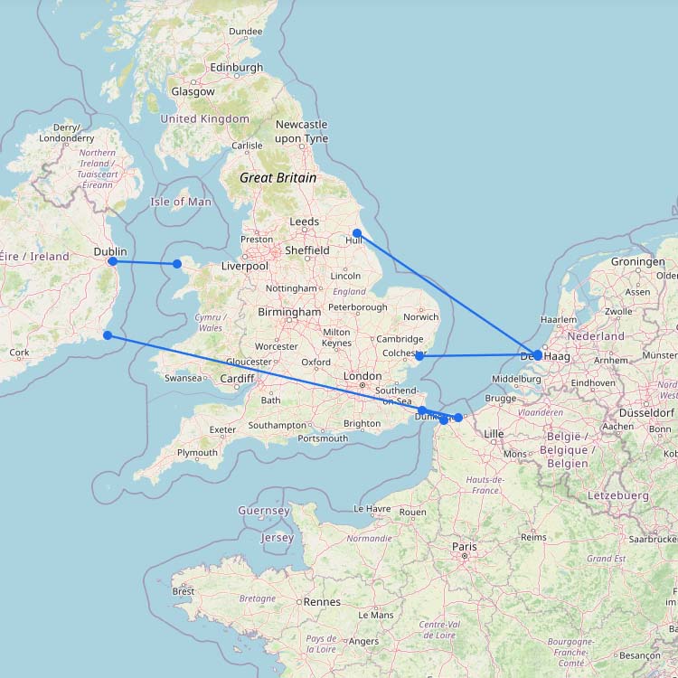
Ferries from Ireland to Belgium
In the past, Belgium had its own ferry port in Zeebrugge, but nowadays you’ll need to rely on…
7
routes
6
connections
5
operators
Explore ferries to this destination
Destination
↗
930
views · 30 days
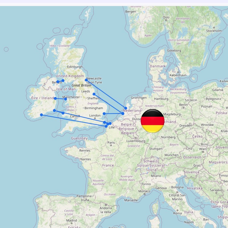
Ferries from Ireland to Germany
There is currently no direct ferry connection from either Ireland or the UK to Germany. If you want…
10
routes
8
connections
5
operators
Explore ferries to this destination
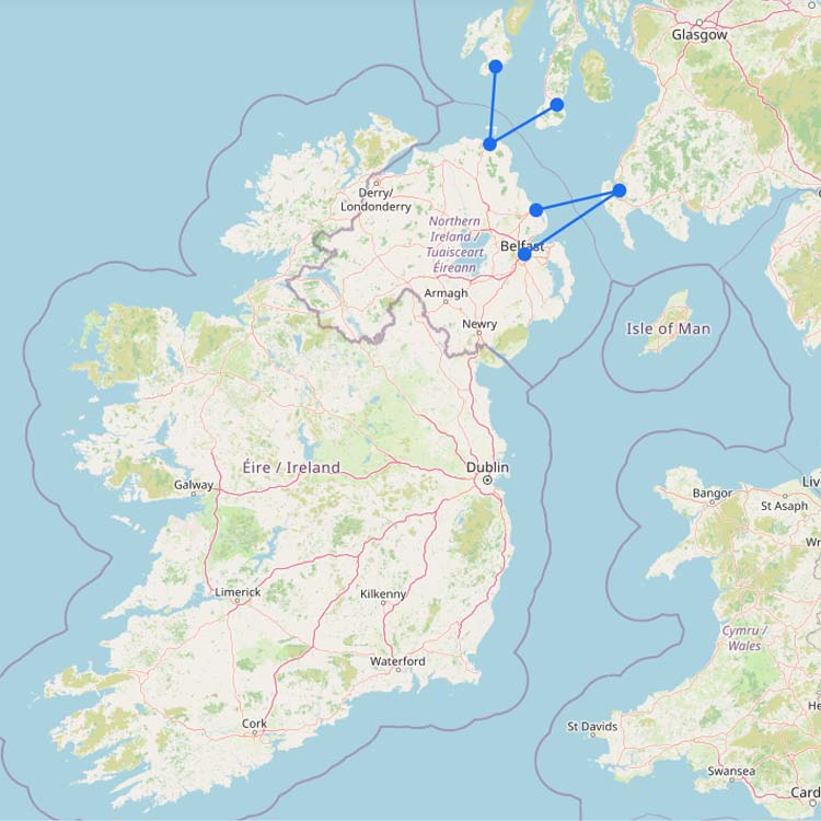
Destination
60
views · 30 days
Ferries from Ireland to Scotland
The easiest route from Ireland to Scotland by ferry is via Northern Ireland. From there, P&O and Stena…
4
routes
6
connections
3
operators
Explore ferries to this destination
No maps match this filter.