+2
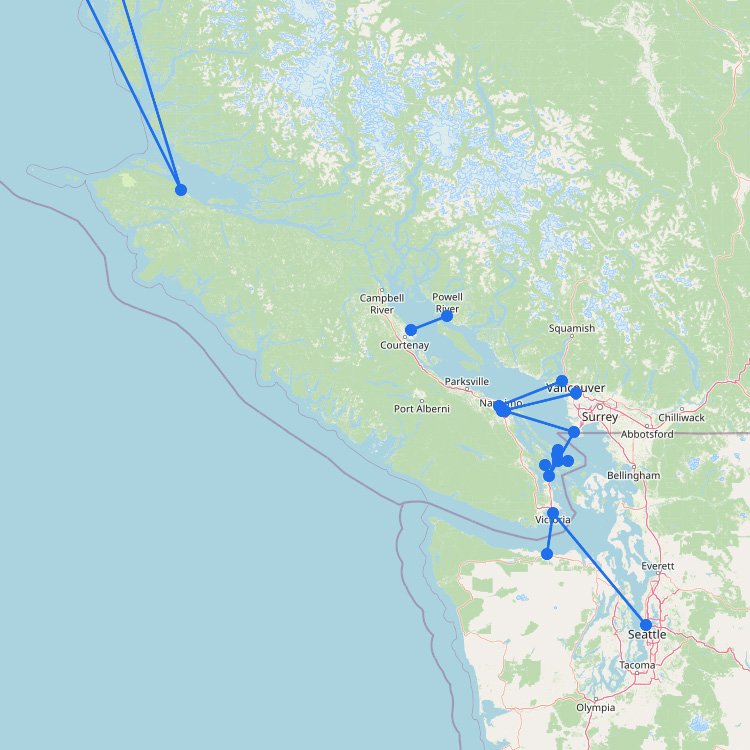
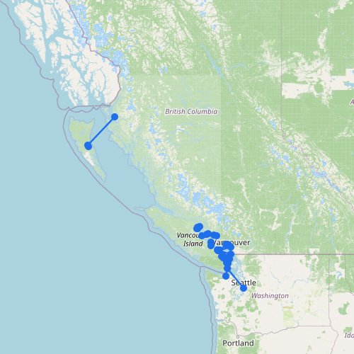
British Columbia Ferry Map
The map above shows why British Columbia has one of the most important ferry systems in North America.โฆ
Home ยป Destinations ยป Manitoulin Island
Getting to Manitoulin Island from the Bruce Peninsula requires a two-hour ride on the MS Chi-Cheemaun. Operated by the Owen Sound Transportation Company, the largest ferry provider in this part of Canada, the boat departs from Tobermory and docks at South Baymouth. This seasonal route lets you bypass the long drive around Georgian Bay. It is a very popular shortcut for road-trippers who might also be heading to Pelee Island later in their journey. The ferry map above shows exactly how this crossing links the mainland to the island.
Showing all 1 services
Accessing Manitoulin Island from Southern Ontario involves a 1 hour and 45 minute crossing of Lake Huron. The MS Chi-Cheemaun (meaning “Big Canoe” in Ojibwe) connects the Bruce Peninsula to the island, saving travelers a 350-kilometer (217 mile) drive around the top of Georgian Bay. This seasonal service is an integral part of Highway 6 and is a major cultural icon of the Great Lakes region.
| Route Terminal | Operating Season | Logistics Score |
|---|---|---|
| Tobermory โ South Baymouth | May 1 to Oct 18, 2026 | The Great Lakes Link: A 40 kilometer (25 mile) transit. Operates 2 to 3 times daily. One-way vehicle fares for the 2026 on-peak season are approximately $49.10 for a standard car plus passenger fees. |
“Don’t spend the whole trip inside the cafeteria. Head to the front observation deck as the ship leaves Tobermory to see the ‘Big Tub’ lighthouse and the shipwrecks in the crystal-clear water of Fathom Five National Marine Park. Itโs some of the best scenery on the Great Lakes and youโll miss it if youโre just waiting in the coffee line.”
Using this terminal data ensures you align your arrival with the mandatory 1-hour check-in deadline: missing this window results in your reservation being voided and your spot being sold to the standby queue. Check our specialized maps to locate the South Baymouth landing relative to the Highway 6 corridor.
+2
The map above shows why British Columbia has one of the most important ferry systems in North America.โฆ
+1
To reach Victoria in British Columbia, you must board the BC Ferries fleet from the Tsawwassen or Horseshoeโฆ
+9
Atlantic Canadaโs ferry routes are closely tied to the North Atlantic. Ferries connect the maritime provinces to islandโฆ
The map above shows how the ferry network around St Lawrence and Quebec is shaped by one ofโฆ
To reach Prince Edward Island by water, you take the Northumberland Ferries (NFL) vessel across the strait fromโฆ
+11
As the map above shows, the Great Lakes ferry network is built around practical shortcuts, island access, andโฆ
No maps match this filter.